Every country on the planet is shaped by stories—conflict, diplomacy, migrations, empires, and human decisions that carved borders into the world map. The lines we see today may look permanent, but many of them were drawn recently, often influenced by power struggles, economic interests, cultural claims, or even natural formations like rivers and mountains. Understanding how countries maps developed and why borders look the way they do reveals not just geography, but centuries of human history.
How the World Divided Its Borders
When we examine a world map, patterns begin to emerge. Some borders follow natural formations, while others are straight lines imposed without regard for local populations. The distribution of boundaries can be grouped into several key methods:
1. Natural Boundaries
These borders follow physical features such as:
- mountain ranges (India–China, France–Italy)
- rivers (United States–Mexico via the Rio Grande)
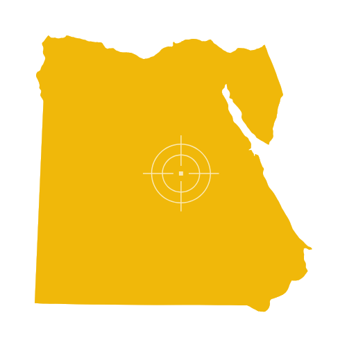
- deserts (Egypt–Libya)
Natural borders historically reduced conflict because they offered a clear physical separation.
2. Cultural and Ethnic Boundaries
These borders were drawn around:
- tribes
- linguistic groups
- religious communities
However, the challenge is that human societies do not fit neatly into lines. As a result, many regions today still face disputes rooted in cultural overlap.
3. Colonial and Political Borders
Large parts of Africa, the Middle East, and Asia were divided by European powers. These borders often ignored local realities, creating long-term political tensions. Many straight-line borders—such as those across the Sahara—are marks of imperial decisions rather than local agreements.
4. Borders Based on Treaties and Wars
When empires rose and fell, borders shifted dramatically. Maps changed after:
- world wars
- independence movements
- dissolution of states
- international agreements
This is where the greatest land losses and gains in history occurred.
Countries That Lost the Most Land in History
The modern map hides the immense territorial changes that shaped today’s world. Some countries shrank drastically, while others expanded or reorganized.
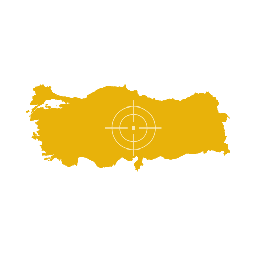
1. The Ottoman Empire → Modern Turkey
Once stretching across Southwest Asia, North Africa, and Southeast Europe, the Ottoman Empire lost around 90% of its land after World War I.
Modern Turkey is only a small fragment of that former territory.
2. Russia and the Soviet Union
Following the dissolution of the USSR in 1991, Russia saw the emergence of:
- Ukraine
- Baltic nations
- Central Asian republics
- Georgia and Armenia
The Soviet territory reduced by roughly 5.6 million square kilometers.
3. Austria-Hungary
Before World War I, it controlled Central and Eastern Europe. After its collapse, it broke into multiple modern countries including:
- Austria
- Hungary
- Czech Republic
- Slovakia
- Slovenia
- Parts of Poland, Romania, Croatia, Bosnia
This was one of the most dramatic reductions in Europe.
4. Germany
Germany lost territory after both world wars, including:
- Alsace-Lorraine
- Regions of Poland
- Portions of East Prussia
Its borders were reshaped repeatedly over the past century.
5. China (historical dynasties)
China’s borders expanded and contracted through dynasties. The Qing Empire once included:
- Mongolia
- Taiwan
- Parts of Central Asia
Over time, these territories evolved into separate nations.
6. The British Empire
The largest empire in history eventually transformed into independent nations across:
- South Asia
- Africa
- Middle East
- Caribbean
- Pacific
While the UK still exists, its empire dissolved into dozens of sovereign states.
Why Some Countries Have Complex or Disputed Borders
The world map includes regions where boundaries remain contested due to:
- overlapping ethnic groups
- unrecognized states
- colonial-era lines
- resource-rich areas
- strategic geography
Examples include Kashmir, Western Sahara, and parts of the South China Sea.
Borders are not just lines—they influence trade, migration, political relations, and even how communities identify themselves.
How Maps Help Us Understand These Shifts
A country map is more than a drawing—it’s a record of:
- historical decisions
- cultural presence
- geographic realities
- political agreements
Studying maps from different periods reveals how fast human civilizations change and how much territory has been gained or lost through time.
FAQs
Which country lost the largest amount of land?
Historically, the Soviet Union’s breakup caused one of the largest land losses in modern times.
Why are some borders straight lines?
These mostly come from colonial agreements where territories were divided without considering local communities.
What shapes most modern borders?
A combination of natural features, colonial decisions, cultural regions, and political negotiations.
Can borders still change today?
Yes. Diplomatic agreements, independence movements, or territorial disputes can shift borders even in the present era.